Arkun
The Arkun project (Figure 1) which covers about 850 square kilometres centred between York and Corrigin 100 km east of Perth, was first identified as an area of anomalous nickel-copper-gold anomalies in publicly available regional geochemistry data sets.

Figure 1. Location and Regional Geology of the Arkun Project and showing key nickel-copper-PGE deposits and recent discoveries.
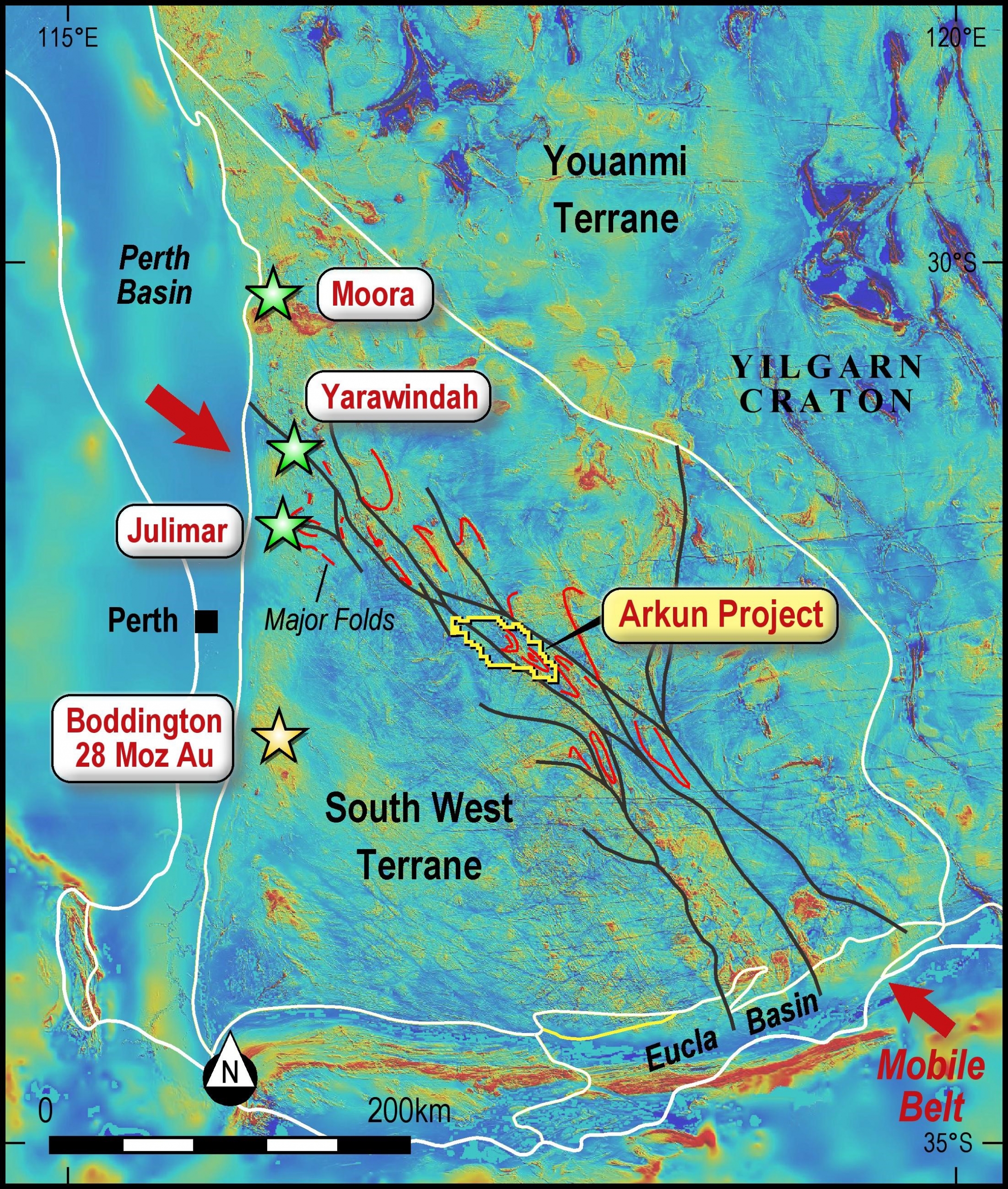
Figure 2. Regional magnetic image showing major structures in the South West Terrane of the Yilgarn Craton. Note the location of the Julimar-Yarawindah-Moora area at the north western end of the interpreted mobile belt.
A subsequent interpretation of regional magnetic data by Impact has identified the area as lying within a major deformation zone or mobile belt that trends NW-SE from the Moora-Julimar-Yarawindah area through Arkun and which may contain deformed and metamorphosed equivalents of those rocks (Figures 1 and 2). This belt is generally not recognised in many regional geology maps and yet is self-evident in the magnetic data. This is a significant breakthrough in understanding for Impact.
The mobile belt is about 500 km long and up to 30 km wide, and is of a scale that suggests it may mark an ancient terrane boundary or proto-craton margin. Such geological provinces (of varying ages) are well known around the world as prospective terranes for hosting major nickel-copper-PGE deposits with examples such as Nova-Bollinger and Mawson (Proterozoic age – Figure 1), the Thomson fold belt in Canada and the recent discoveries at Yarawindah and Julimar in Western Australia (Figures 1 and 2).
In addition, the project is centred on a significant WNW-trending gravity high evident in regional gravity data (Figure 3). This is also a very encouraging signature indicating that reasonable amounts of denser crust occur at depth in the project area and are interpreted as mafic and ultramafic rocks. Such gravity highs are also common to many nickel provinces globally.
The regional magnetic data shows numerous “eye structures” similar to those at Nova-Bollinger and used a targeting criterion for similar deposits throughout the Albany-Fraser Province (Figures 1 and 4). These structures have the geometry of refolded folds and are typical of the deformation style of the mobile belt (Figure 2).
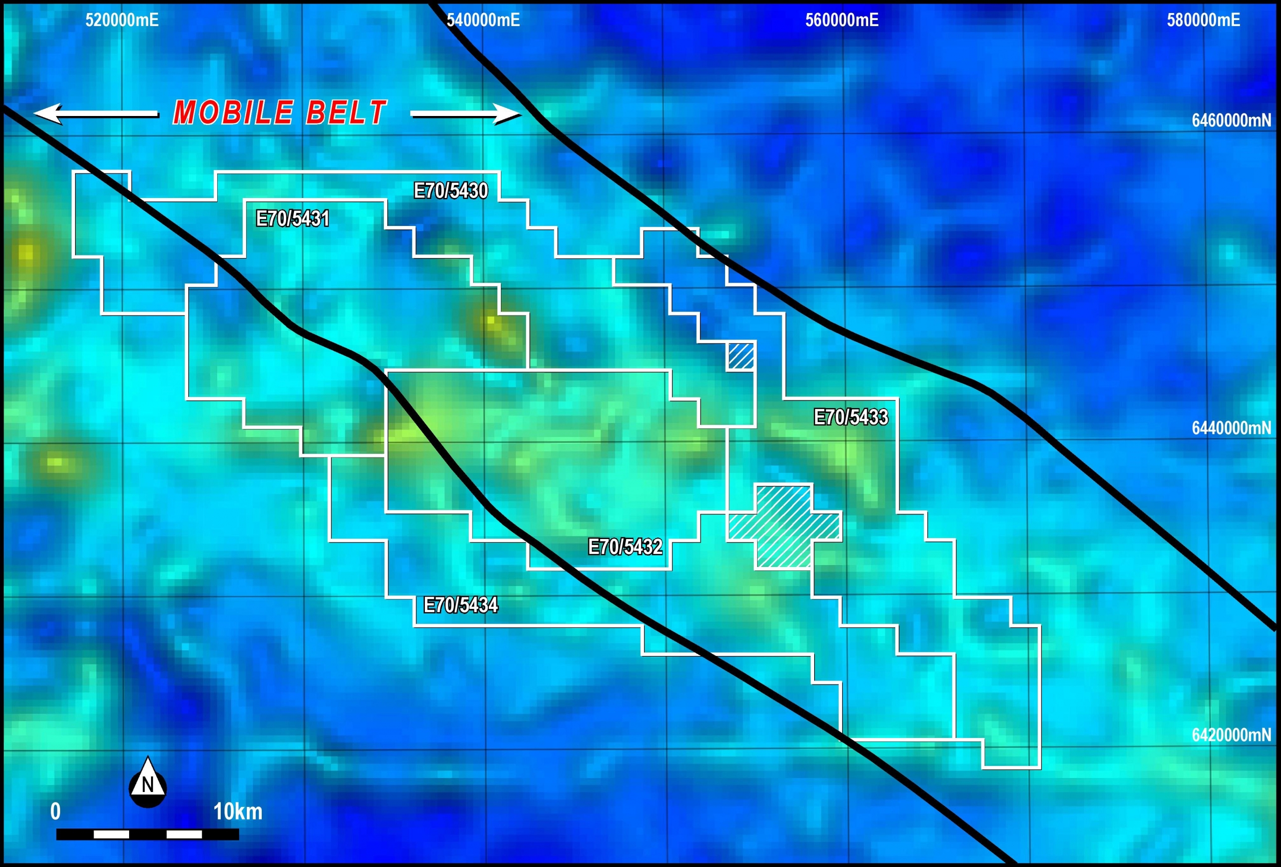
Figure 3. Broad gravity high in regional gravity data image (warmer colours indicate more dense rocks). The WNW trending zone marks a major gravity feature within the South West Terrane. Hatched areas are excised from Impact’s tenement holdings.

Figure 4. Image of the regional magnetic data (warmer colours representing more magnetic rocks). Numerous elongate “eye-structures” are clearly visible.
Regional Geochemical Anomalies
The Arkun project also covers several soil and rock chip geochemical anomalies for nickel, copper and gold in regional datasets with widely spaced samples (Figure 5, see JORC table for details on the sampling and analytical techniques).
Nickel anomalies are present in the publicly available state-wide regolith geochemistry dataset available from the CSIRO (https://publications.csiro.au/publications/#publication/PIprocite:3fe12d41-ac73-4a8a-8420-47816f0fa509) with samples taken a nominal 9 kilometres apart (Figure 5).
The copper and gold anomalies were identified in a soil geochemistry dataset that is proprietary to Impact’s consultants Milford Resources Pty Ltd with samples taken at about 500 metres apart along roads and tracks.
Nickel values range up to 96 ppm, copper values up to 174 ppm and gold up to 11.5 ppb (Figure 5).
Although these absolute values are modest, the entire area is dominated by sandy soils developed on various substrates. It is well known that such sandy soils may significantly dilute soil geochemistry responses and background values are estimated to less than 10 ppm for nickel and copper and no more than 1 ppb for gold.
Figure 5. Images of the regional soil geochemistry data showing sample locations, and nickel, copper and gold results. Nickel values range up to 96 ppm (CSIRO data only), copper values up to 174 ppm and gold up to 11.5 ppb (proprietary data, no nickel assays). Warmer colours represent higher assay values.
Accordingly, the anomalous samples are about 10 to 20 times background. Impact considers these responses to be significant given the vast distances between samples.
Expansion of the Arkun Project
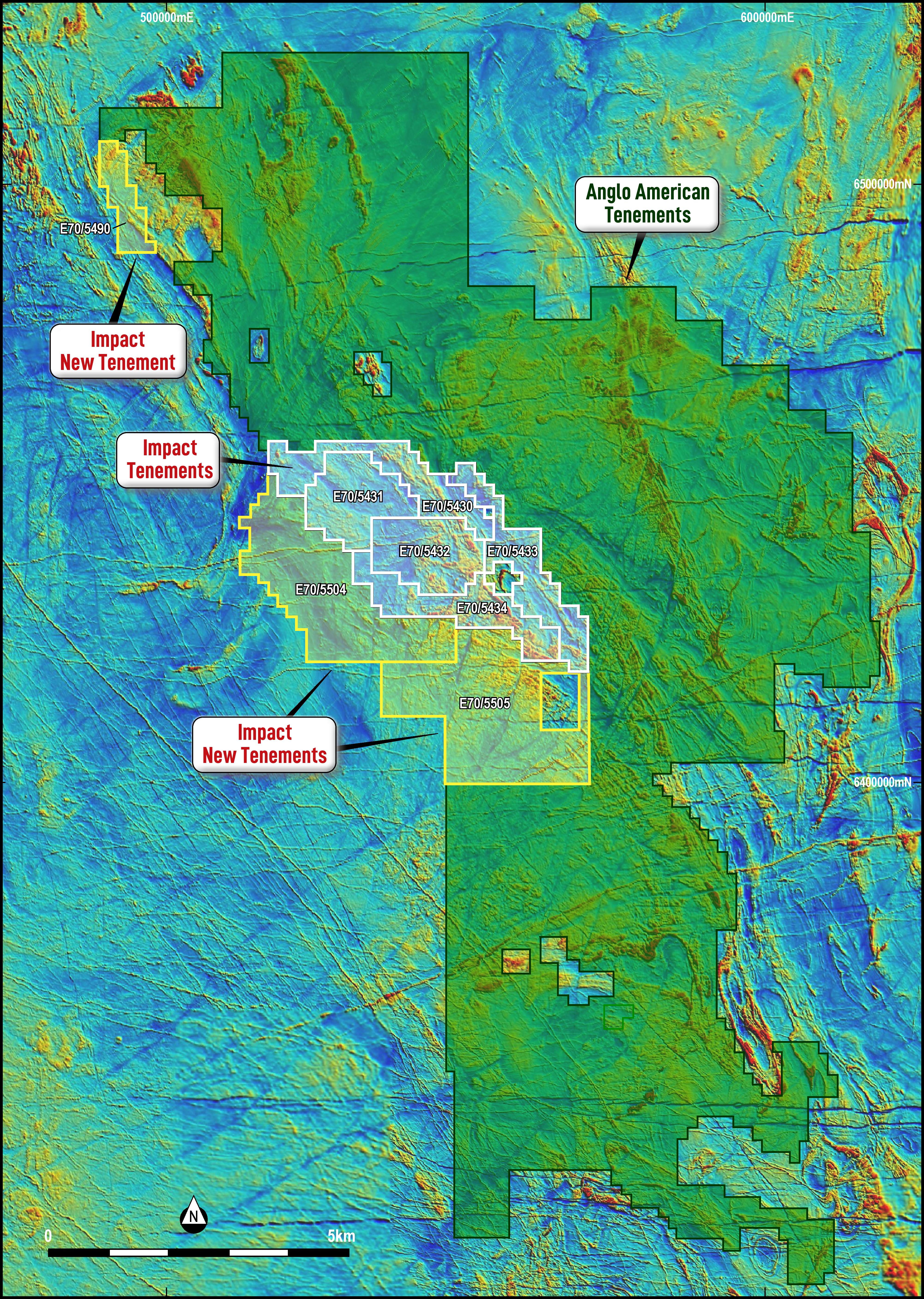 Figure 6. Impact Minerals and Anglo American plc Exploration Licence Applications at Arkun on an image of regional magnetic data.
Following the initial recognition of the Arkun project by Impact, Anglo American plc, one of the world’s leading mining companies and an active explorer for nickel-copper and platinum group metals subsequently staked a vast area of some 10,130 square kilometres directly surrounding three sides of Impact’s project area (Figures 6 and 7).
Accordingly Impact also expanded its holdings and the project now covers 1,900 sq km.
Anglo’s applications, which comprise one of the largest holdings by a single company in Western Australia, were lodged on the afternoon of 29 May 2020. This was shortly after Impact released its first announcement on Arkun that morning (ASX: IPT Release 29 May 2020).
Impact Minerals Limited Managing Director Dr Mike Jones said “We view the arrival of one of the world’s largest mining companies in the middle of the Western Australian wheat belt as a very positive endorsement our exploration targeting criteria at Arkun. In addition, it is also an endorsement of the entire concept of a new emerging nickel-copper-PGE province in this part of WA thanks to the recent discoveries at Julimar and Yarawindah.”
“In addition we think it is also a direct recognition of the importance of the proposed mobile belt in this part of the State, a belt we have recently understood to be explored for diamonds in the past, and that we interpret to be a deep structure that may have tapped the mantle and allowed nickel-copper and platinum group metals to migrate into the crust.
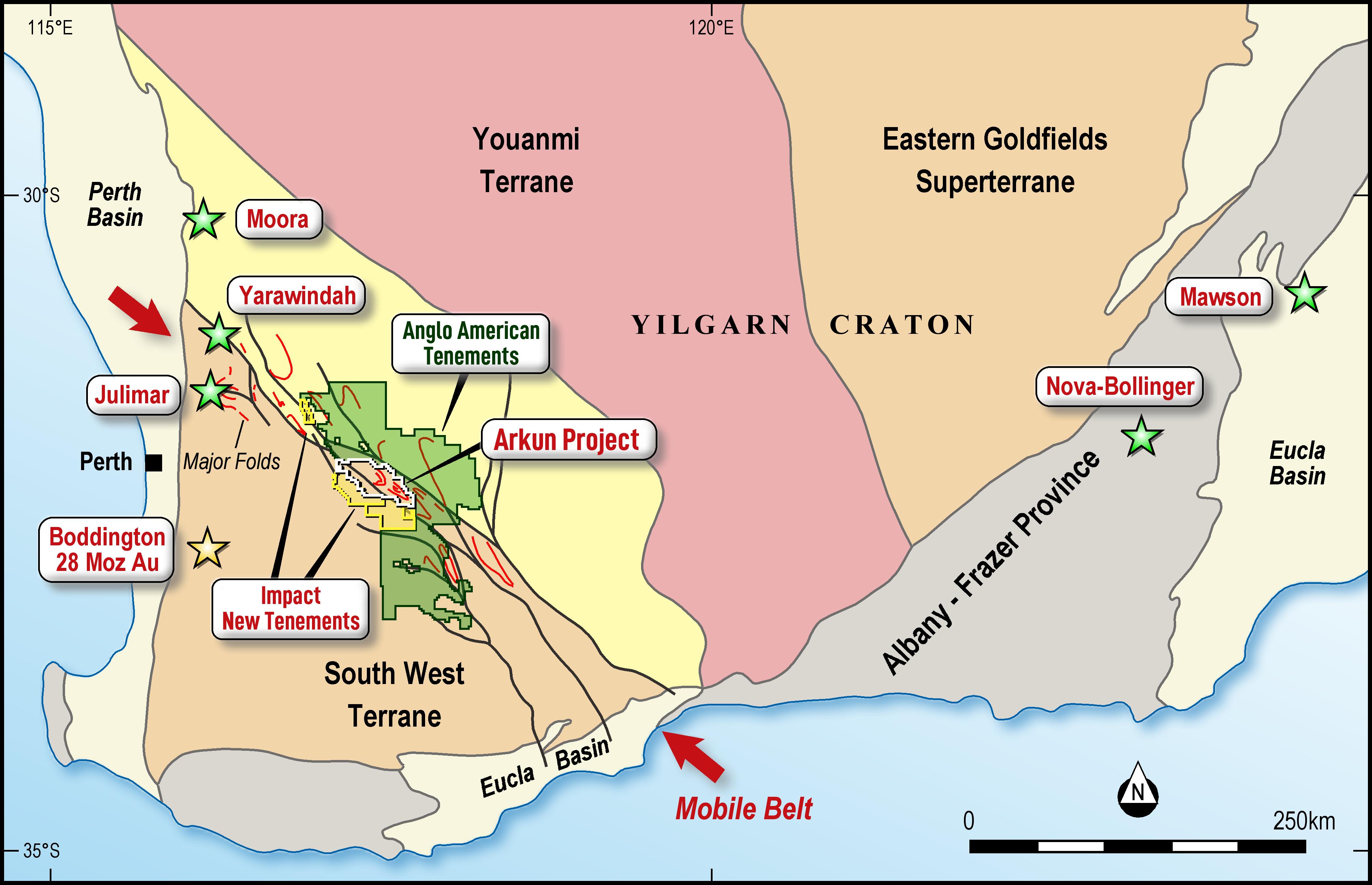
Figure 7. Location and Regional Geology of the Arkun Project and showing key nickel-copper-PGE deposits and recent discoveries.
“Such deep structures are critical components to the formation of major deposits like Nova-Bollinger and the recent discovery at Mawson. Impact is currently completing reconnaissance work along roads and tracks to move this exciting project forward before grant whilst waiting for statutory drilling approvals at our priority nickel-copper-PGE project at Broken Hill,” Dr Jones said.
Next Steps
The eight tenement applications (E70/5430-34, E70/5490 and E70/5504-5505) are now pending grant, a process expected to take about 5 months. However, Impact intends to undertake reconnaissance work along gazetted roads and tracks to help accelerate exploration prior to grant.
In addition, an interpretation of the surface geology will be completed to assess the effectiveness of the previous soil geochemistry surveys to determine the best surface geochemistry technique for the area. A detailed interpretation of the bedrock geology from the magnetic data will be completed to help identify other priority areas for follow up.